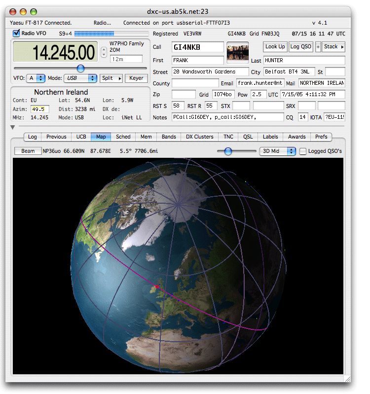
Amateur Radio Logging Software 3D World display option
MacLoggerDX - 3D Option - A whole new dimension in log visualization !

3D Option Manual Page...
- The MacLoggerDX 3D Option displays a true 3D model of the earth complete with accurate grayline terminator, 12 degree grayline corridor and Sun shading.
- Instantly switch back and forth between 2D and 3D maps with the '3D' checkbox.
- A great circle helps to visualize the short and long path from your QTH to the DX Spot automatically.
- You can easily spin the world with the mouse in real time for a better look at the path.
- DXSpots as well as logged QSO's and cities can be picked from the map to display distance, bearing and QSO data.
- Rolling over the spots displays their info in the map status line.
- Clicking on a spot loads it into MacLoggerDX.
- Cities are marked by orange points.
- DX Spots are marked by green points.
- Logged QSO's are marked by yellow points.